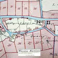
2.2 History and pattern of development
The Parish has been inhabited since at least
Iron Age times. The Domesday Book records Alvestone (Olveston)
and Tockintone (Tockington) and 66 inhabitants! In 1711 the
two villages and surrounding land had a population of 240.
At the 1991 census it stood at 2045.
The first areas to be settled were on the land
above the Levels above the 50 foot contour where Olveston,
Tockington and Ingst stand today. Olveston is the largest
village. It has evolved from a linear pattern of development
along The Street. In contrast, Tockington is a compact village
centred on a small village green. Ingst essentially comprises
a group of farms. Old Down is a later settlement developed
on higher land cleared from the woodland of the Kingswood
Forest and from enclosed common land.
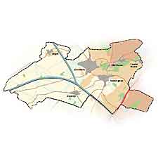
Much of the development in the villages took
place between 1700 and 1900. Since then there have been further
distinct periods of growth notably in the late 1920s and 1930s
- with Council houses; in the early 1950s - with completion
of The Crescent, Old Down and Orchard Rise, Olveston; in the
1960s - Manor Park, Tockington and The Apples closes and part
of Denys Court, Olveston; and in the 1980s - Ley Lane, Olveston.
The Bristol Green Belt was established in the
mid 1950s and approved by Government in 1968. Subsequent development
has been limited largely to infilling. |